A couple of months ago I had the pleasure of visiting Fly Ranch which was recently bought by the Burning Man Project. I was kicking around the idea with Will Peterson about mapping a section of this area which would provide them with an overview of the ranch. Why do this, well aerial mapping with drones has come a long way when I first started (almost 2 1/2 years ago) and their are many reasons one would want to do this. A few examples would be agriculture, construction and inspection. For example with agriculture you can fly over the same area during each part of the year to see how your crops are doing and spot areas that might be dying or having issues. Normally to do this you would have fly in a helicopter and try to spot the issues from the air, which well with the advancement of drones you can simple have it do the same pattern and process the data once done to see how things are fairing in your fields.
Construction and Inspection are also other great options for mapping out locations. For instance lets say on Fly Ranch they wanted to place various buildings on the property. Normally you may just try to use Google maps and draw out areas that you would want to have your buildings/structures at. This might be enough for some people but here is where it gets interesting. With the mapped data processed though various applications you can generate a 3d model which then you could use to actually place additional 3d models created such as houses, buildings, tower etc to give you an idea of how things will actually look. Also taking this a step further you can use various technology to show in realtime how light and weather may effect the buildings placement.
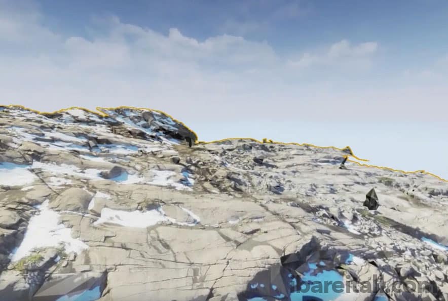
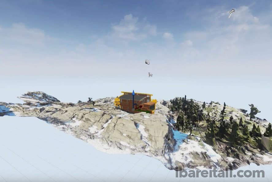
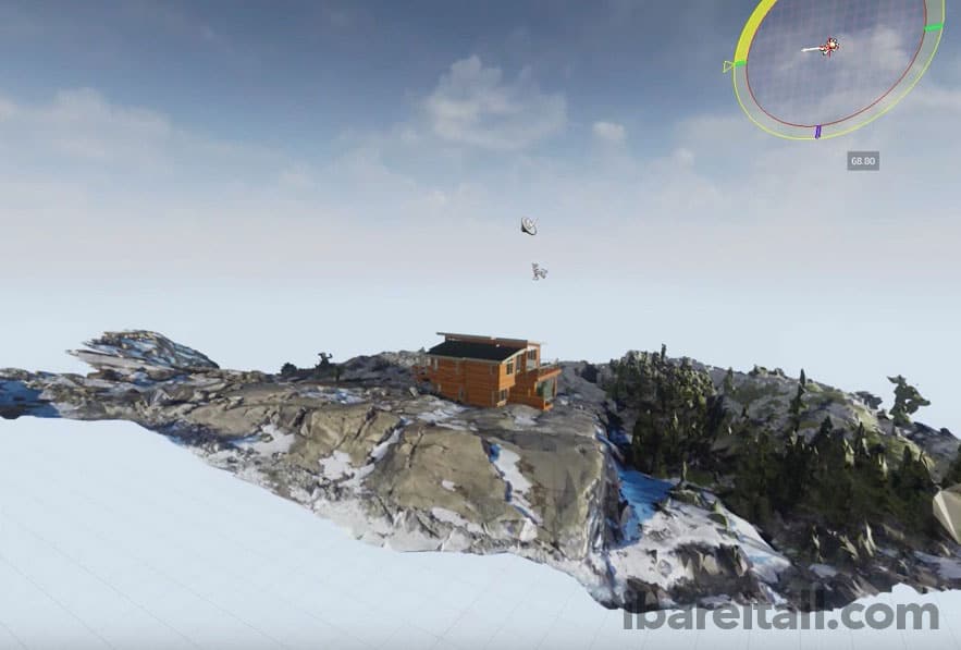
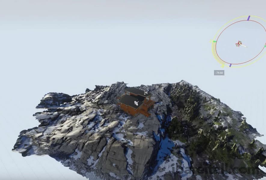
Below is an example of mapping out an area and placing a building on the actual 3d mapped data. (sorry for the watermarks, I have had people use my stuff w/o permission in the past). This is a bit more advanced and off topic but it can give you an idea of whats possible.
-

- Actually data created from the drone.
-
- Custom House model on top of the 3d landscape data.
-
- Example of how you can use light to see how it hits your house.
-
- Another example of how you can use light to see how it hits your house.
So as you can see above this is a mixture of aerial data with an extra and additional house model on top top of it. I would assume you can imagine the possibilities, and one thing to note the software I use will allow a user to also strap on a VR headset and walk around in this virtual world created.
Ok so back to Fly Ranch. The challenge is to figure out the best way with the tools you have to execute this process of mapping 400 acres or more. Things to consider is which drone to use, how many batteries you need and the software you will used to pull off the mapping part. I chose to use my trusty DJI Phantom 4 for the job since at the time it had the most battery life per battery for a small prosumer drone. Next was choosing the right software to help you preplan your flight and get an estimate on how many batteries you might use. While many companies are coming out of the wood work at the time I choose DroneDeploy which allows you to preplan your missions first on the web and then sync* them to your mobile device.
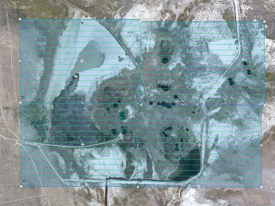
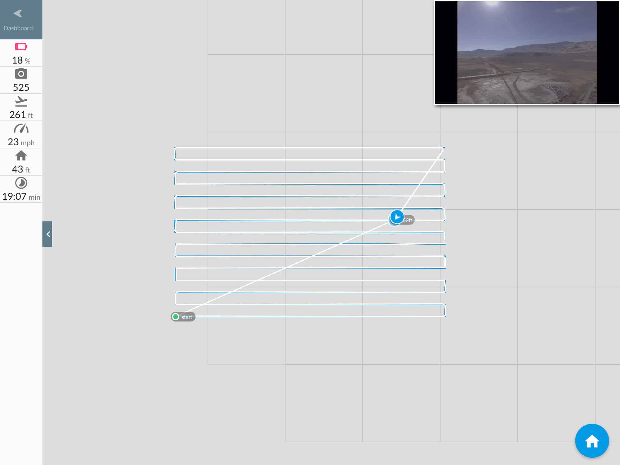
So armed with my Phantom 4 and 4 batteries that last anywhere from 18-22 minutes depending on conditions I headed out to Gerlach, NV to stay with Will. The DroneDeploy preplanned mission it seemed like 4 batteries would be enough to pull off this job. Below are 4 sections that I photoshopped together to give you an idea of the area covered (about 400 acres).

4 Sections that map almost to 400 acres at Fly Ranch.
While this doesn’t look so big 400 acres is about .625 square miles. I choose to do 4 sections with one battery each since well I was testing out the software and didn’t want to risk any issues with not getting data. They do have the option which I choose not to test of allowing you to generate one big flight map and having it come back to swap batteries and continue off where it left off. The 20+ years of being a software developer I always choose to avoid any risks or bugs which Ill explain I ran into further below.
So the next day Will and I drove over to Fly Ranch, which is an amazing journey and well when you pull into the lot where Fly Geyser is your a bit in awe (See my video of the Geyser shot with my Inspire 1).
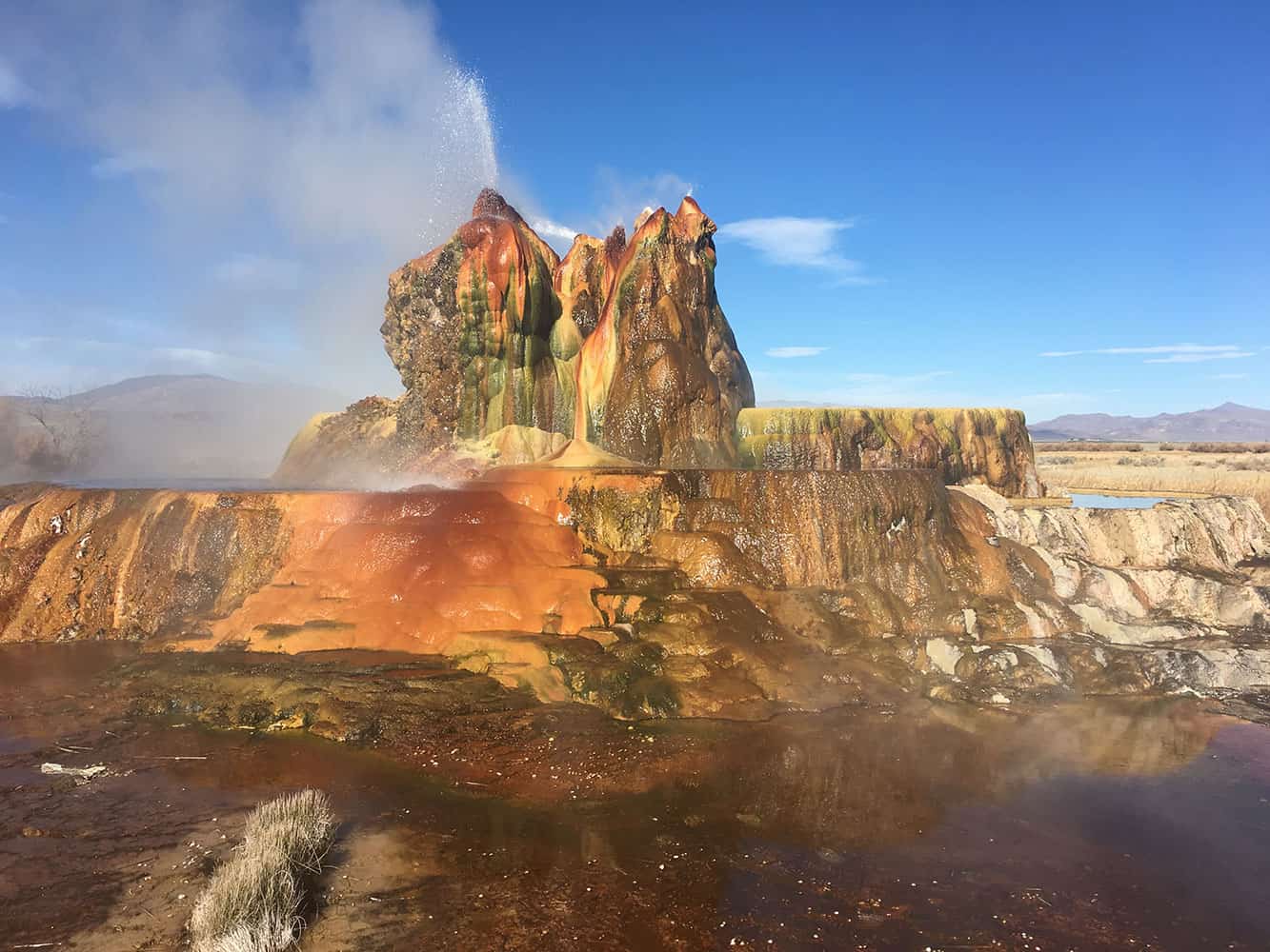
Amazing!
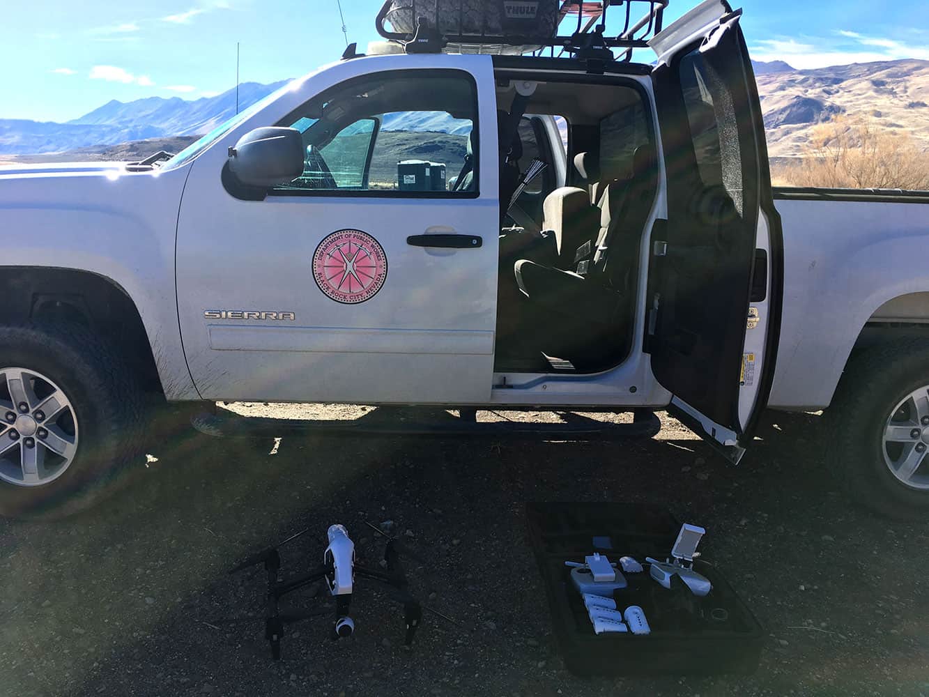
Inspire 1 waiting its turn.
So here is the first issue I ran into which well I knew about prior to going out. If you have no cell reception your map wont show up nor can you sync the map area to fly the drone. So always make sure to test your software with and without reception and see if it works for you. Luckily I had at Wills house pulled up the maps on my iPad and left it w/o doing anything else, like closing or killing the app. However even though I did this I did run into an issue where if I would pinch or zoom the app all of the sudden my mapping data below would disappear.
Opps, where is my google map data!
I don’t panic easily and trusted the software along with having a visual line of site of the Phantom 4 I felt I would let it do its job. Just a reminder to everyone you can have the Phantom 4 come back to the home point at any time, just make sure its set first.
So what I did find out is that the calculations of battery usage per section was a bit tight even though the P4 should push over 22 minutes I was getting 20 and for each section per battery I almost didn’t get to fully map the area. Again no big deal, always keep your eye on the battery and hit the panic button on the remote, just be sure to give it enough battery to fly to the home point or your going to end up doing an emergency landing at the position it is at.
Again DroneDeploy does have the ability to map a section and have it return back to allow you to swap batteries and continue where it left off and I believe that the map cacheing issue is fixed but always make sure you do some test runs somewhere before trying to do a test job like this. I have to day the DJI Phantom 4 performed flawlessly and is my goto mapping drone for right now.
After mapping each section you will end up with a lot of photos, I think the count I had was at almost 2000.
Part 2 of this article will explain what to do after you have all this data, the software I tested and the results.
Lessons learned:
- Test test test your drone and the software you pick to map areas.
- Always do preflight checks
- Make sure all your batteries are charged
- Check your props and make sure you have extra ones.
- Have more batteries than you need.
- Set the camera to manual mode, auto might change the exposure depending on what your flying over.
- Make sure you have your memory card in the drone and also make sure there is enough space for these data sets.
- Test your app with/without cell/wifi reception.
- Scale down your map area a bit to provide the drone enough time to complete it and safely fly back to you.
- Do not panic when things go wrong, trust your drone and either manually fly it back or hit the home button on the controller.
- Make sure you’re not flying over people and check the airspace your in to avoid any issues with the FAA.
- Backup or copy your image data.
- Give a stranger a hug. Ok last one didn’t happen that day but I think thats an over all lesson to be spread 🙂
Links:
Special thanks to Will Roger Peterson, the Burning Man Project and DJI.