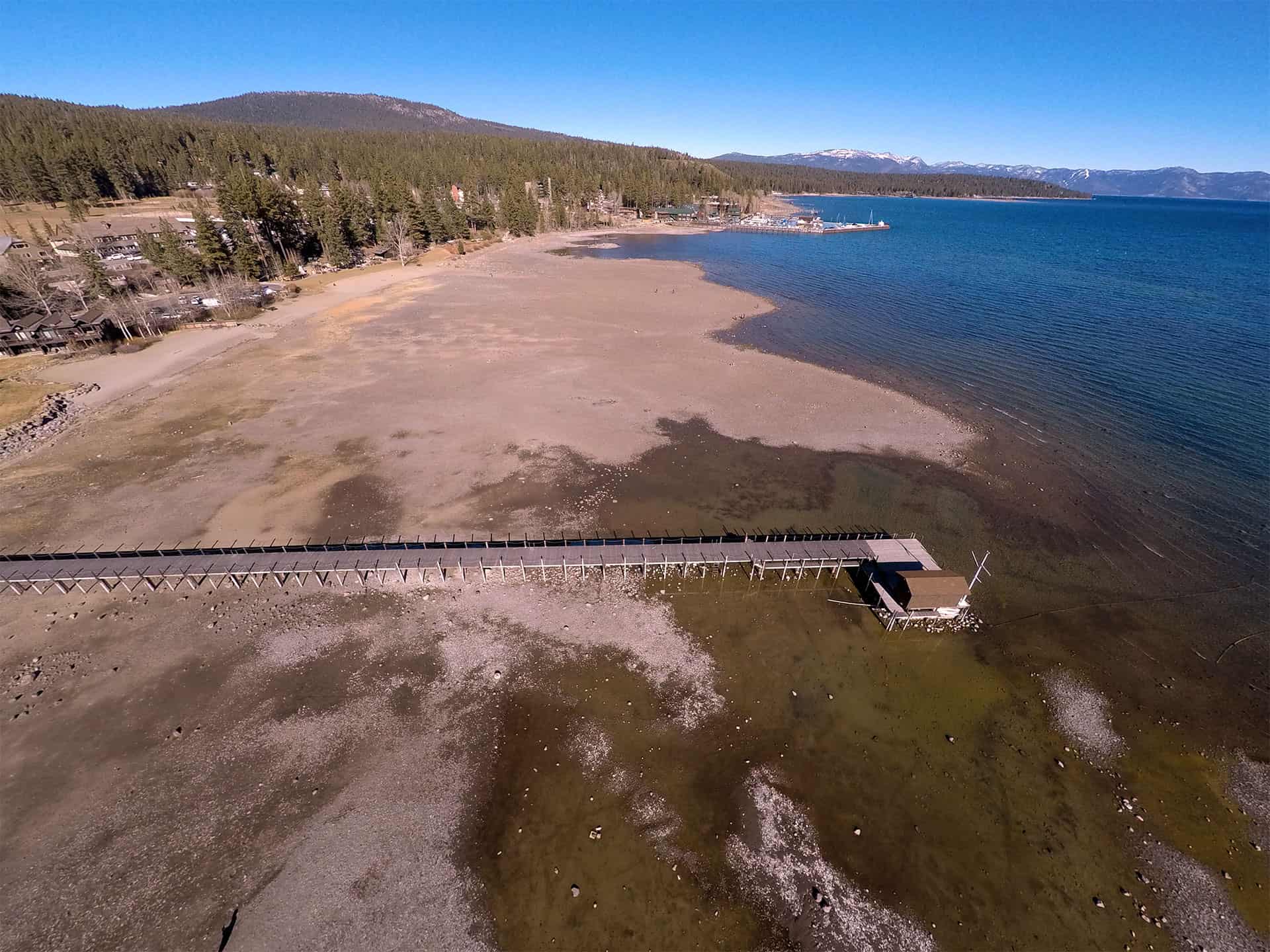
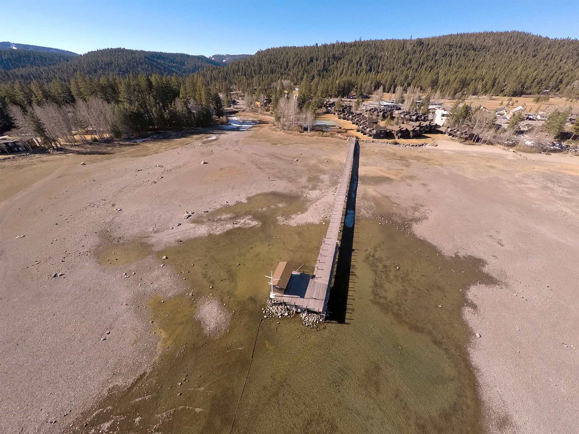
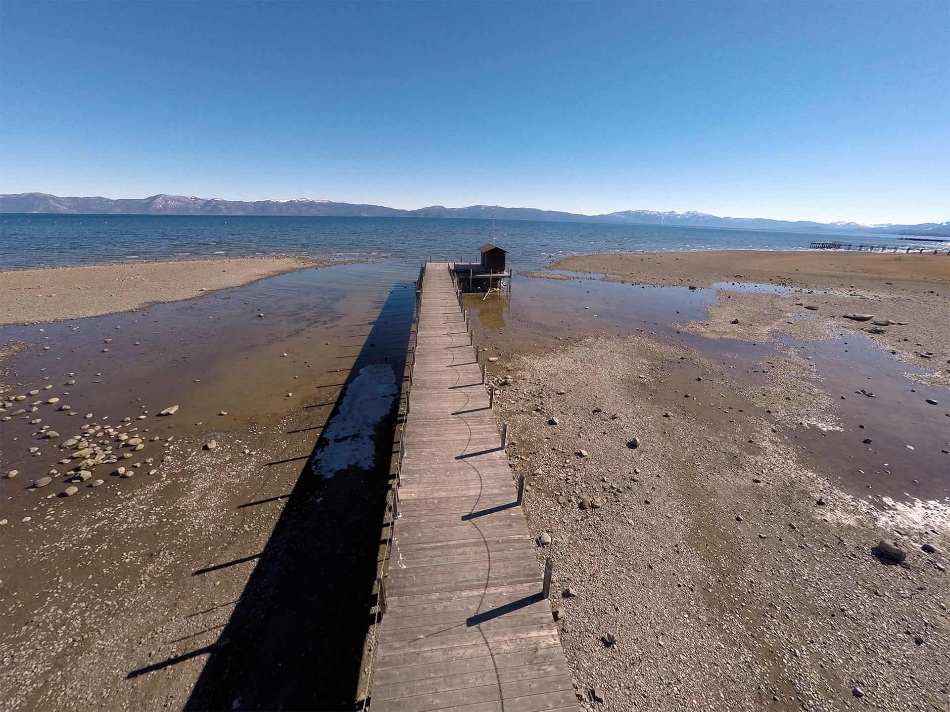
Over the past few years we have been facing a drought here in California and for those of us fortunate enough to live in Lake Tahoe this was very evident. Just go to any beach and you will find your self being able to walk on dry dirt/sand for several hundred feet out before even hitting water. I live in Tahoe City and have been tracking this for the last few years by taking aerial photos of the Tahoe City Dam, Commons Beach and the dock near Commons Beach pictured below.
-

- Commons Beach
-
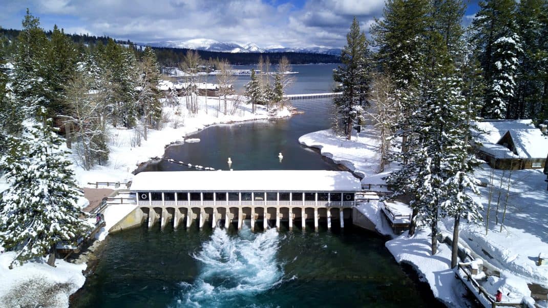
- Commons Beach and Tahoe City Dam with no water!
Well the draught here in California is over and the water is flowing full blast out of the Tahoe Dam, in fact its pushing out as of this writing 1180 cubic feet per second (source). However now we are facing the potential to pass the legal limit height for the lake which is 6,229.1 feet and we are currently around 6,227.52. I would assume this could lead to flooding in lower areas around the lake and various parts on the Truckee River.
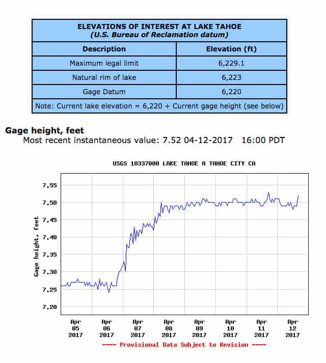
Current Height Level of Lake Tahoe April 12, 2017
Since I usually fly my drones around this area to practice I have captured over time the changes we have experience from 2015 to 2017. This footage was just throw away shots but I managed to dig out some clips from the past few years and put together this video below.
Enjoy and contact me if you have any questions.